VGR Tech
Data and geospatial analyst and technology trainer with client-focused communication skills and problem-solving capacity to improve workflows, processes, and data storytelling.

Data and geospatial analyst and technology trainer with client-focused communication skills and problem-solving capacity to improve workflows, processes, and data storytelling.
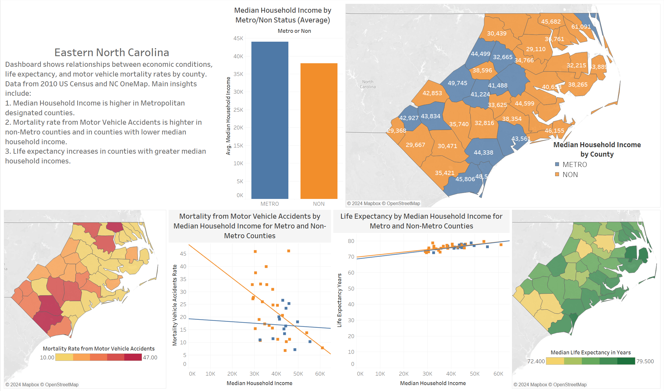
Problem: What are relationships between income, urban status, and mortality?
Solution: Create dashboard in Tableau using 2010 health and census data for Eastern North Carolina Counties.
Effect: Improve visualization of data for students and researchers enrolled in Medical Geography course.
 Link on Tableau Public
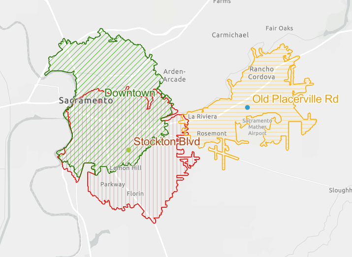
Problem: Use files from a class to identify the most suitable site for a new coffee shop in Sacramento, CA.
Solution: Geospatial analysis tools including network analysis, service area analysis, and kernel density were applied to data to generate a Site Suitability Analysis.
Effect: Results from the analysis indicated the Downtown location was preferred given the parameters for the analysis. A presentation was created in AGOL StoryMaps to show the results.
 Link to ArcGIS StoryMaps